
The Land
4,300 HECTARES OF PATAGONIA
Almahue stretches from 600 to 1,300 metres above sea level, across dry slopes, rocky ridges, sheltered valleys and native vegetation.
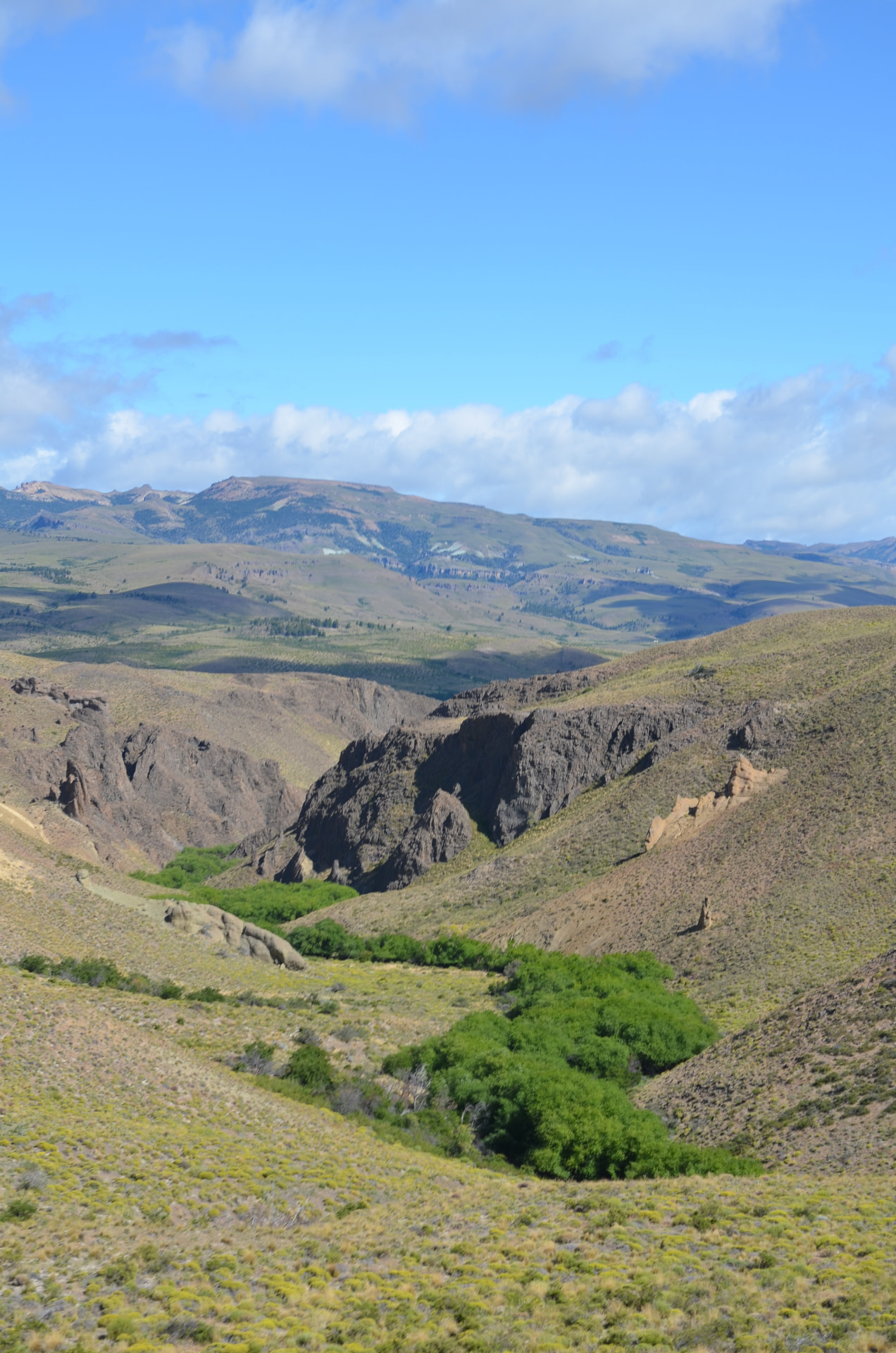
ALMAHUE IN THE FIELD
A glimpse of the landscape, the terrain and the work taking place across Almahue.
LANDSCAPE CONDITIONS
600–1,300 m
Elevation range
700 m
Elevation difference across Almahue
15+ species
Tested under different field conditions
INTA
Scientific collaboration and restoration mapping
Rainfall
2025: approx. 200 mm
2026: more than 400 mm by 25 October
Conditions change significantly across Almahue. Altitude, exposure, soils, vegetation and water availability vary from one area to another. Rainfall also varies strongly from year to year, which makes water retention and storage a central part of Almahue’s restoration strategy.
A LANDSCAPE OF CONTRASTS
Arid areas sit beside greener corridors, natural regeneration and more protected zones. This diversity makes Almahue both fragile and full of restoration potential.
WATER DEFINES THE LANDSCAPE
Water is scarce and unevenly distributed. Understanding how it moves — and how long it can remain in the landscape — is essential to every restoration decision.
DIFFERENT LAND. DIFFERENT RESPONSES.
Some areas are suited to planting. Others are better protected, monitored or left to regenerate naturally.
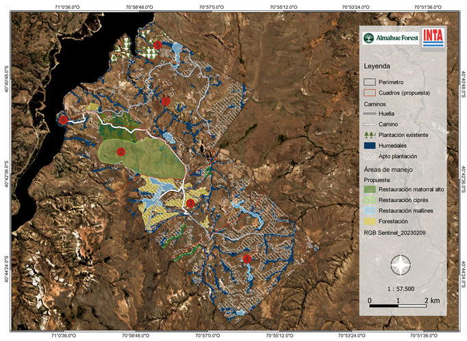
4,300 ha | 600–1,300 m | Patagonia, Argentina | Restoration since 2022